Blog Post by Emma
We’ve visited the Midi Pyrenees in France five times now. On our first two trips, we spent just one week here, before moving onto other destinations in the French Northern or Southern Alps. However, every time we moved on, we both felt a deep longing to stay. Since then, we’ve extended our time here, and have certainly not been bored when spending three weeks in the Saint Lary Soulan area.
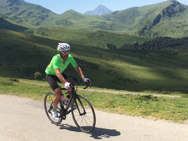
There are so many fantastic rides from Saint Lary Soulan, with many of the climbs made famous (or notorious) by the Tour de France, within easy reach. One of our favourites is a loop that comprises of three Cols: the Horquette d’Ancizan, Col du Tourmalet and Col d’Aspin.
From Saint Lary Soulan, it’s only a few miles to the pretty village of Ancizan, much of which you can do away from the main valley road. The main Cols are signed for, so you can easily spot the left turn which indicates the start of the Horquette. Helpful markers will tell you how far it is to the summit, and the average gradient of the next kilometre awaiting you! I love having this info, but on occasions it can make you groan, when you keep seeing 10% average, marker after marker. This isn’t the case on the Horquette, but certainly can be on other climbs in this area.
This early slopes of the Horquette are tree lined, and it’s been very quiet on the occasions we’ve ridden it. It’s gradient is challenging but does not contain anything too brutal, but it’s a very constant climb, winding up and up, for around 10km.
After approximately 4 km, the gradient eases a little and you head out of the trees. A spectacular view of the snow tipped mountains opens out, and you can look down on the pretty towns below. This allows you to take a breather and enjoy the landscape, before the road takes you back into the trees, with the gradient increasing again.
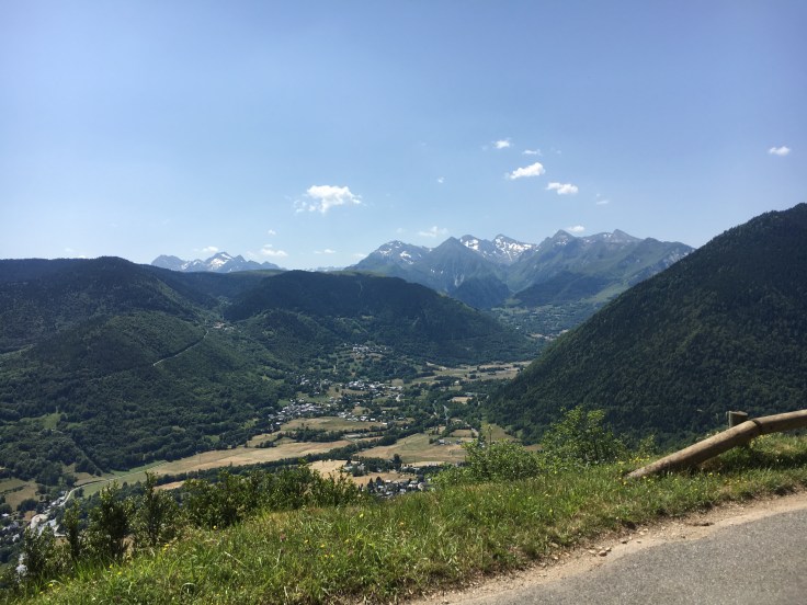
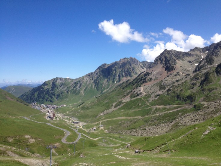
The panorama at the summit is stunning, and we were lucky to experience a cloud inversion on our recent ascent of this beautiful mountain. We could just see the Pic du Midi, but the tip was only visible for a short time, amidst a wisp of grey cloud.
Horquette d’Ancizan looking towards Pic du Midi, hidden by cloud
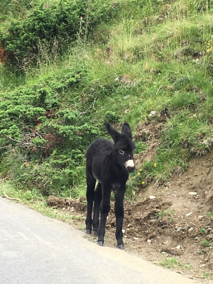
The descent to Payolle is so picturesque. As you are riding through a pastoral area, it is not uncommon to have your downhill disrupted by donkeys, cows or wild horses! The green slopes of the mountainside look so bright and clean with the vivid blue sky backdrop. I love hearing the trickle of mountain streams, harmonious alongside the sound of birds, and little else. Payolle is a popular tourist area, there is a lake, plenty of space for camper vans and it looks very scenic for walking. You will find a shop/bar/cafe where you can stock up on water and food.
From here there is a fast, winding piece of road that takes you all the way to Sainte Marie de Campan, where we start our ascent of Col du Tourmalet. It’s 16 kilometres from here, so approximately 10 miles. Having ridden this legendary climb several times, with good and bad experiences, we chose to fuel up at Payolle, and I also took on a caffeine gel when we reached Sainte Marie de Campan.
The first 3 kilometres have a shallow gradient, but the climb gets real at the village of Gripp! There are many websites that will give you detailed gradient information, such as http://www.climbbybike.com. A short tunnel is a marker for when the road starts to kick upwards and from here the trees are thicker on your right, but less so on your left where you can see views of valley below. Another feature is a waterfall, where the climb eases a touch, a good spot to take a drink.
From my recollections of this climb, the gradients range from 7% to 10% after Gripp, and they steepen (or perhaps I am just feeling the fatigue more) when you reach a series of snow tunnels. After the tunnels comes the famed resort town of La Mongie, and again the climb becomes harder. It’s usually fairly busy here; there always seems to be some kind of construction work going on, and the town has a resident donkey who just wanders at the side of the road.
La Mongie
After La Mongie, the summit isn’t too far, my legs are usually cursing me at this point, but not on this day, as a tailwind made the journey through the resort distinctly easier than usual! The Tourmalet summit is basically chaos! There is very little open space for the masses of cyclists, motorbikers and motorists that congregate there. Everybody wants a photo by the sign and the famous sculpture, but obtaining this can be tricky! There is a bar should you be in need of refreshments, and a narrow viewing area, amongst the cars and motorbikes parked up. It’s good to soak up the atmosphere for a short time, and admire the amazing views from both sides of this magnificent mountain.


Our loop takes us back down the Tourmalet, the way we came, so a cracking downhill for the demon descenders amongst you. In my case, it’s a steady one, my dislike of descending through the snow tunnels niggling in the back of my mind. Typically, hardly any vehicles were behind me on the way down, until I reached the longest snow tunnel, the one I was not looking forward to! The gradient in the tunnel is quite steep, which sometimes gives me the unsettling feeling of “hurtling” and the surface was a little bumpy and damp; the sound of traffic is amplified, so a tiny car sounds like an HGV on your tail! I got through it of course, but was glad when that section was over.

Grant was waiting for me in Sainte Marie de Campan, and we agreed we had enough water to get us back to Payolle where we could stock up in readiness for the last climb of the day, Col d’Aspin. Whenever I’ve descended this road earlier in the ride, it’s always been in the back of my mind that riding back up it, with the Tourmalet in my legs, is going to be really difficult. However, on every occasion, it’s never been too bad at all, the gradients being shallow in comparison with the last Col! Eating plenty is definitely the key for me, on rides like this.
It was still scorching when we arrived at Payolle for the second time that day. The area was really heaving now, as the Tour de France was passing through during the two days that followed. The number of camper vans had increased significantly since we rode through in the morning. The climb of the Aspin from this approach is easier than from the Arreau side, in length and gradient. It is a beautiful climb though, winding through the trees, with a fabulous vista awaiting you, and most likely a herd of cows!
With tired legs, we reached the summit, again it was camper van chaos, but all in good nature. We both chatted with Australian riders who were on a ten days tour, riding from Bordeaux to Barcelona. They had also had a great day, taking lunch on the Pic du Midi.
Grant loves the descent off the Aspin back to Arreau, but due to the impending arrival of the Tour, the road was busier than usual, so not as much fun was to be had! For me, I was just pleased to descend a particular long, fast section that I’d previously not enjoyed, and feel more at ease on it. A definite sign of improvement, with no thoughts of “I don’t like this bit” playing in my mind!
From Arreau, it was a steady trundle back on quiet roads to our base near Saint Lary Soulan. The loop is 66 miles, with approximately 2900m of ascent, according to my Garmin. It was a fairly long day on the bike but one that brought smiles alongside the tired legs. We later pondered that we could, in future, tag on the Col Val Louron d’Azet as well, to give us a longer route, probably around 80 miles. One to look toward to, when we next return to my beautiful Pyrenees!


September 10, 2016 at 1:26 am
Fantastic write up. I agree the Pyrenees are just an amazing place to ride and the countryside is so beautiful. I always feel like I’m transported back in time a bit when I’ve been there. So quaint and beautiful. That is a great loop as well. Did you ride the route de labs whilst at Saint Lary? Definitely my favourite.
LikeLiked by 1 person
September 11, 2016 at 9:13 am
Hi Bella thank you so glad you liked it. I would never get bored of riding there! Yes we did the Route des Lacs, love Lac d’Aumar. Probably one of the prettiest. We’re pondering a trip to a different part of the Pyrenees, near the Ax les Thermes area, maybe next year. If you’ve been near there, I’d love to know what you think. Emma
LikeLike